What was built
An interactive geospatial analysis surface using ward-level metrics and spatial-significance results.
Data & Geospatial Systems
Expose spatial hot and cold spots across city wards while preserving geographic and statistical context.
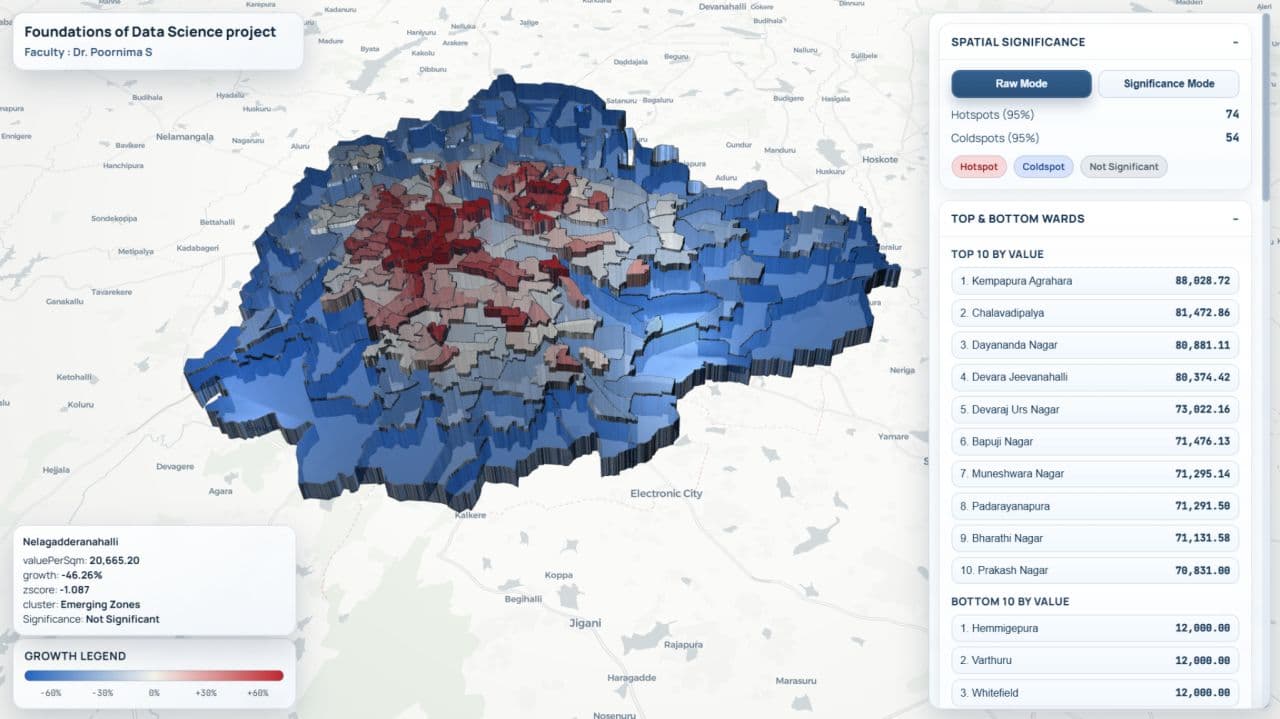
An interactive geospatial analysis surface using ward-level metrics and spatial-significance results.
Data preparation, spatial analysis, projection work, visualization, and application integration.
Python · PyProj · PySAL · pandas · Matplotlib